Effective action needs accessible science
- Posted by Chris Brown
- On July 1, 2019
Coastal wetlands are globally threatened. However, the plight of these habitats, like mangrove forests, seagrass meadows and saltmarshes, is not well recognised relative to other coastal ecosystems, such as coral reefs. This translates into funding shortfalls both for the science needed to address coastal wetland decline and for the protection and restoration actions needed to support these ecosystems.
The Global Wetlands Project has started to address this gap by demonstrating how coastal wetlands are a missing, but crucial link, for informing existing biodiversity indicators. This is important, because these indicators are used to set policy and inform conservation funding.
Our aim is to accelerate the uptake of coastal wetland science into indicators and policies. Right now, we’re 12 months into this 4 year project and have already created new understanding and tools in three crucial areas: fisheries indicators, marine megafauna and coastal blue carbon.
Fisheries indicators
The debate around the global status of fish stocks is of immense policy importance – not only does overfishing impact ecosystems but it also impacts economies, livelihoods and food security. A key challenge has been to analyse the status of stocks with respect to fishing pressure.
There are 418 fish stocks that have high quality assessment data and are most commonly used to inform global indicators of fisheries. We found that 49% of these stocks use at risk habitats, especially mangroves and seagrass.
However, indicators of fishery status don’t recognise the contribution of habitat loss to declining fisheries. This means actions to address overfishing through regulating fishing are only solving part of the problem. Protecting and restoring coastal habitats may be crucial to support fisheries livelihoods and global food security.
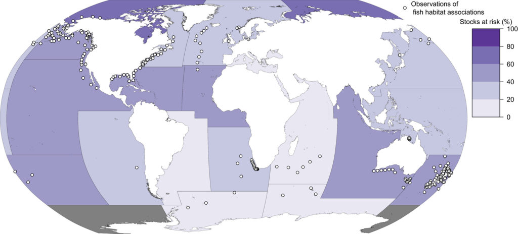
The Food and Agricultural Administration’s major fisheries areas and the per cent of stocks from a global stock assessment database that use the at‐risk habitats: tropical corals, seagrass, mangroves or macroalgae. From Brown et al. (2018).
Marine megafauna
The International Union for the Conservation of Nature’s Red List compiles data contributed by scientists and experts to assess the risk of species extinction. Red Lists are an essential part of how countries and international agencies distribute funds to support the protection of threatened species. An important part of the assessment is documented the causes of decline, because these inform on conservation actions.
GLOW researcher Dr Michael Sievers led a global review of links between marine megafauna and vegetated coastal wetland habitats. Before the review, the number of marine megafauna species known to use these habitats was 110, according to Red List. We identified another 64 species from 340 published studies, bringing the total number to 174 species. This means 13% of all marine megafauna use vegetated coastal wetlands.
However, many of these links were not included in existing IUCN assessments. This potentially undermines the role of coastal wetland conservation as a means to address the species extinction crisis.
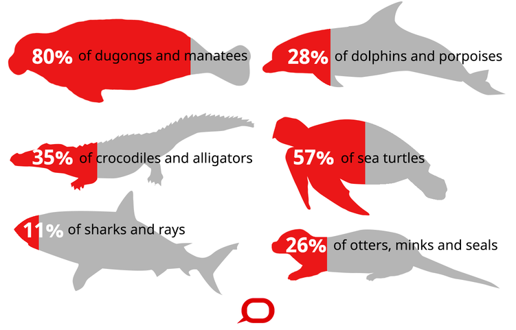
Proportion of species from each marine megafauna group that uses vegetated coastal wetlands to live, breed and/or feed. Created by The Conversation using data from Sievers et al. (2019)
Blue carbon calculator
Countries are accounting for the sources contributing to their national carbon emissions so they can identify priorities for avoiding emissions and meet targets set under the Paris Climate Agreement.
GLOW researcher Dr Fernanda Adame modelled carbon emissions from land clearing of mangroves Mexico. She found that national carbon accounts, used in the Paris Climate Agreement, underestimated carbon emissions from mangroves by 31 times.
This happened because carbon emissions from clearing mangroves were treated in the same way as any other wetland. But, mangroves also trap carbon in their soils, so emissions from clearing mangroves are much higher than typical wetlands.
This devaluing of emissions from mangrove clearing means funding for reducing deforestation is not appropriately targeted towards mangroves. Correcting the calculations helped Mexico properly value the blue carbon storage of their mangrove habitats.
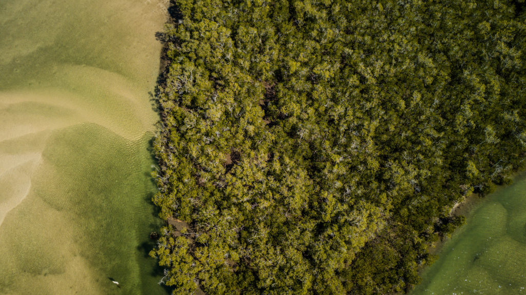
Mangroves store significant amounts of blue carbon. Accounting for this storage capacity helps countries properly value their coastal assets. Image: Tom Rayner.
Data for decision making
It’s one thing to point out gaps, but we want policy makers to use this information in assessments. That is why our project has integrated science communication from ground zero. We are also turning our science into accessible, user-friendly tools. This includes open source models, open source data and web apps.
As The Global Wetlands Project progresses, we are working to bring this understanding together in a comprehensive index of coastal wetland health that can support conservation decisions about protection and restoration.



0 Comments